You probably know the feeling of being on a rollercoaster when the car goes around a curve and turns almost upside down, and what was once on your left and ahead of you is now actually beneath and behind you. So, you never see that landscape because you were bent by force to look another direction.
That is pretty much the fate of Ecuador’s southeastern regions of Morona Santiago and Zamora Chinchipe. Unfortunately, travelers heading south are so bent on seeing Cuenca and then west to Guayaquil and the beaches, that sadly, another area so incredibly rich in culture and nature is just put out of view. They never knew it was there until it’s too late.
About Gualaquiza
We’re talking about a large area spread across two provinces, but for visitors who enjoy history, archaeology, and adventure, the epicenter of it all is Gualaquiza. Around this humble dew-laden town lies ancient secrets that when you have a chance to see them, you feel like you are the first one to discover Machu Picchu.
You will still find the native Shuar communities in and around Gualaquiza, who were the true first inhabitants of the area. Thus, spending time with them through local community tourism opportunities, allows you to hear the oldest of stories about the land and its people.

The city itself was founded in 1815 by the Franciscan priest, Father José Prieto, so you will see his name invoked in civic memorials and historical recounting. He is credited for rediscovering the ancient city of Logroño which encompasses both the El Remanso and Buenos Aires ruins that you will read about further below, and these have also come to be known as “the Prieto sites”.
Where to see the ancient ruins of Gualaquiza
There are numerous sites in the Gualaquiza area, but generally they can be divided into two routes. You can do either, or a combination of the two, but you will need a guide as many are on private land or without clear trails. This, of course, makes them more exciting.
Aguacate Route
Going northwest of Gualaquiza near the village of Aguacate sits the impressive El Remanso, which was forgotten since Prieto’s discovery until 1958 when Salesian Missionaries came across it in their documenting the area.
Further scientific research at the site has revealed that the ruins are of Cañari origin (pre-Inca) and are around 2,500 years old. You will find remains of a whole structural stone complex with walls, roadways, canals, and the foundations of dwellings. Multiple ancient agricultural terraces are also in the same vicinity. While mostly moved to museums now, fossil bones, as well as potsherds and vessels, were discovered in a plantation at the foot of a burial mound (a tola). Up at the top of the tola there are tunnels two meters in diameter that lead to the interior, but they are still in too fragile a condition to have been explored.

A second set of ruins is more elusive, deeper into the mountains near to the village of Bermejos and to the west of the mountain Runahurco that is sought out by hikers and birders. There is still scant information about this archaeological site, so the best thing to do is ask for a guide at the local museum in Gualaquiza (Museo Arqueológico Municipal), which also serves as an extension for the town’s tourism office.
Nueva Tarqui route
The second route going a bit south and west from Gualaquiza has five ancient ruins in store.
The most well-known are also the closest, existing in the Nueva Tarqui parish immediately west of Gualaquiza, and they are El Cady and Buenos Aires.
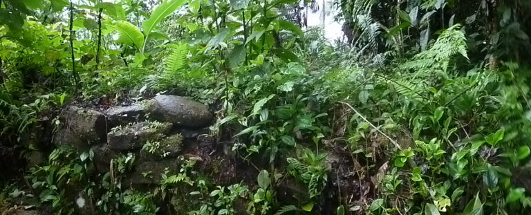
 Source: Photo by Kali Kucera, 2013
 Stone structures in Buenos Aires include walls, stacked platforms, and one in the shape of a canal. Three oval-shaped stone barriers, each roughly 1 meter high and half a meter broad, are erected 100 meters apart.
There is a 50 by 30-meter platform at the top of the site, and the stones are thought to have been carried from the lower zone because there are no stones of that sort nearby.
Because of its lofty and strategic location, the Buenos Aires site is thought to have been an old military base used primarily for observation and monitoring. It is possible to observe movement along the Bomboiza river and the hills in the opposing Yutui mountain range.
Local residents say there are similar constructions in a straight line, which would suggest these helped create an important form of communication for the ancient settlers along this area of the cloud forest.
The remains of El Cady (called La Florida) and Nueva Zaruma are located to the west and east of Buenos Aires, respectively. They each feature overlapping platforms with 2×1 ditches that entirely surround each site, much like a moat. There are also many big agricultural terraces, each around 20 to 80 meters apart.
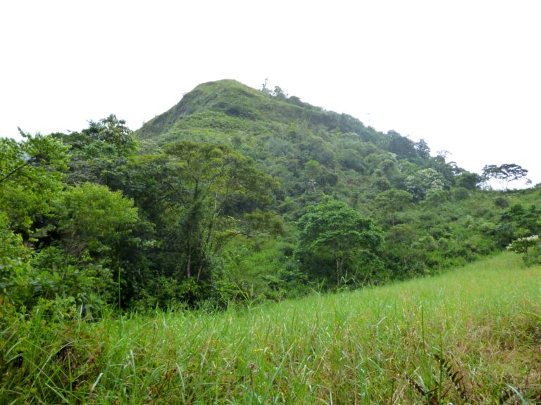
The Las Trincheras ruins are located in the parish to the west, around the side of a mountain range. They are situated on top of a tiny mountain covered in cloud forest flora, with views of the Cuyes River valley, the Ganazhuma pueblos, and the surrounding mountains.
Finally, the Santo Pamba Ruins (also known as Espiritu Playas) are double the distance traveled and located in a remote area of the high cloud forest. This is an important archeological and natural site right now, and the vegetation is so active that it swiftly covers the walls. But the reward is that it is also adorned with orchids and mosses, giving it an appearance that is mystical and dreamy.
Petroglyphs
In addition to the various ruins in the area, there are also some great rock carvings where you can encounter messages communicated up to ten-thousand years ago. One is just to the south of town, known as Bomboiza, and the second set of petroglyphs are just north of town, called El Empalme. Bomboiza is the most visited and accessible.
The petroglyphs are images engraved by humans on stone, using sticks, sharp stones or bones. The carvings were used to record facts, visions, and tell stories.
The Bomboiza petroglyphs are next to an entrance to a local farm and consist of three large rocks. On two of the rocks you can see drawings and strange figures of animals and human faces whose meaning has not yet been deciphered. Look at the first stone and you will see seven drawings with rounded lines that are forming some spatial relationship with each other. In the second stone, there is a large circle with two small circles drawn in the upper portion, and below you’ll see a rounded line that begins and ends in a spiral.
For the love of water!
Whether you love waterfalls, river rafting, or natural pools and jungle beaches, Gualaquiza is packed with diversions to enjoy the paradise it has thanks to its abundance of water flowing through its hills.
Waterfall hikes
There are three main waterfall hikes, and fortunately they are all easy. The first is the Las Culebrillas waterfall and is only 3 kilometers north of town in the La Dolorosa barrio. There you begin a pleasant 25-minute hike through a canyon of orchids and birds, and arrive to the most gorgeous waterfall to bathe in.
Keep walking from there another twenty minutes to get to the cavern and falls of La Dolorosa. There are signs and guideposts along the path to keep you in the right direction. However, this is a more challenging and risk-laden bit of nature, and we absolutely recommend going with a guide, and taking a helmet if you are going into the cavern.
The next level up is to the west of Gualaquiza, and does really require you have a guide, as it’s the fierce and muscular falls of El Guabi. From the trailhead, you will need to commit to a full hour of hiking through meadows, farm pastures, but seeing local flora and even smaller waterfalls along the way. These smaller falls are named Cascadas del Carmen and Tapir. Finally, you get to the prize and grandest of them all, El Guabi, which towers at 80 meters in height with a single drop down into the pool at its base.
Rafting
One of the favorite activities sought out by travelers to Gualaquiza is rafting on the Cuyes River. The adventure begins in the Nueva Tarqui parish and takes you eight kilometers (about two hours) downriver towards the beach at La Unión. Rafting guides are certified by the International Rafting Federation and have all the equipment suitable for the trip. You will be able to observe birds, nature, and have a whole lot of fun.

Not really a raft, but a long open traditional canoe designed for taking dozens of passengers down the navigable river Zamora, is what you can do for a more Amazonian flavor. The trip begins in the sector of Proveeduría 15 minutes from the center of the Gualaquiza and floats you down the Zamora river through small indigenous and river-based communities until arriving at Las Peñas, a native Shuar community. Plan about four hours for the whole trip.
Getting to and from Gualaquiza

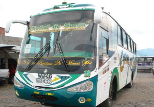
You can order a bus ticket online through the home page from Cuenca, Loja, Macas, or Quito. For a more door-to-door service, we also provide private transfers from all these same cities that you can customize your reservation on our Private Shuttles page.

What should I be prepared to eat in Gualaquiza?
You will be surprised to find out, but also pleased, that the traditions of Gualaquiza span both Amazonian and Sierran (mountain) cuisine of Ecuador. However, they lean more towards the highland cooking that you would find in Cuenca and Loja, even though the native traditions are more of that of the Amazon. So, either way, if you favor meat and starches (chicken, pork, guinea pig!) and potatoes and corn, then you will find plenty of it the same as you would in the highlands. If you are more vegetarian or vegan, the Amazonian traditions (namely from the indigenous Shuar) are there too, emphasizing lots of fruits (citrus, papaya, pineapple, watermelon, banana), vegetables (lettuce, cabbage, radishes, coriander, celery), and starches (yucca, sweet potato, and palm).
At breakfasts you can expect to see bananas with cheese and coffee as regular fare, or ground plantain with cheese, yucca with cheese, or yucca tortillas. These are usually accompanied by fresh orange juice, tree tomato, pineapple, or papaya, all harvested right out the back door.
When it comes to lunch, the main meal of the day, everyone loves to head to the restaurants serving fried or roasted tilapia and the famous jugo de caña, which is fresh-squeezed juice of the sugar cane. During the part of the year that is Fiesta de La Chonta (March through June), all the people of Gualaquiza are busy preparing and fermenting their unique specialty, which is the fruit of local palm trees that has a flavor similar to a peach. You’ll find this turned into candies, cakes, and beverages.


